Application background of Rivers and Lakes water level online monitoring station
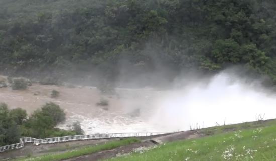
In recent years, extreme weather occurs frequently, and disasters such as rainstorm, flood and drought have increased the threat to Rivers and Lakes. The traditional artificial water level measurement method has problems such as low frequency, large error and slow response, which is difficult to meet the needs of real-time early warning and scientific decision-making. At the same time, with the advancement of water conservancy informatization construction, accurately grasping the water level change trend of Rivers and Lakes has become the key to ensuring flood control safety, optimizing water resource allocation, and maintaining water ecological balance. In this context, the online monitoring station for Rivers and Lakes monitoring water level, relying on high-precision sensors and the Internet of Things technology, realizes automatic collection, real-time transmission and intelligent analysis of water level data all day long, which can not only capture the flood rise in advance, provide data support for reservoir flood discharge scheduling, but also dynamically assess the water resource status in dry season, helping water conservancy departments improve disaster prevention capabilities and water resource management efficiency.
Hardware equipment
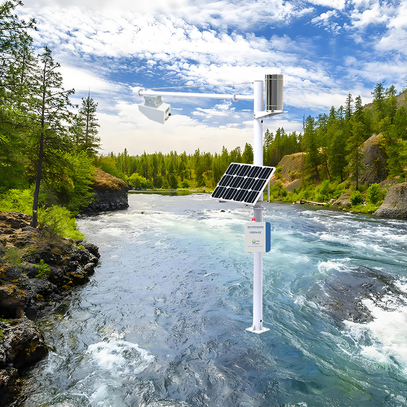
OSEN-SW Water Level Online Monitoring Station
The OSEN-SW water level online monitoring station is an unmanned water level online monitoring system that integrates water level data collection, storage, transmission, and management. The water level monitoring station consists of three parts: front-end radar water level gauge sensor, data acquisition instrument, and computer software. The data acquisition device has functions such as water level data acquisition, real-time clock, timed storage of hydrological data, parameter setting, user-friendly human-machine interface, and standard communication. The system is equipped with a large capacity FLASH storage chip; Multiple communication interfaces can easily establish wired communication connections with computers, and the GPRS wireless communication module can also achieve remote wireless connection between hydrological equipment and computer monitoring centers.
PRODUCT FUNCTION
24/7, high-frequency microwave ranging technology, strong anti-interference ability, achieving high-precision (millimeter level), large range (30 meters, 70 meters), high performance, easy installation, and maintenance free technological leap for water level gauges;
Non contact measurement, combined with cross-sectional parameters to calculate flow rate, not affected by wind, temperature, haze, sediment, floating debris, etc.
The microcomputer monitoring data acquisition device has functions such as data acquisition, real-time clock, timed storage, parameter setting, and continuous transmission of parameters and meteorological historical data when disconnected from the network; Chinese 7-inch LCD touch screen with user-friendly interface.
Flexible system networking method, communication function supporting MODBUS communication protocol, providing multiple communication methods such as standard wired (RS485) and wireless (GPRS) for users to choose from. A flexible meteorological monitoring system is composed of meteorological calculations.
Reliable power supply system.
Provide multiple power supply methods such as mains, DC, and solar systems for users to choose from; Adopting outdoor design, metal spray painted brackets, and outdoor protective boxes, the appearance is beautiful, and it plays a role in rain, wind, theft, corrosion resistance, and anti-interference.
The data browsing function can provide multiple data browsing ways for users to choose, such as LAN data browsing, Internet data browsing, and mobile data browsing.

System Characteristics
Power supply system: Dual power supply system, AC 220V, battery, solar power supply system, etc., can be selected according to user needs, and can flexibly switch between mains power and solar power. Intelligent control of mains power and battery power supply sequence ensures uninterrupted power supply to equipment, thereby ensuring data integrity.
Reliable operation in various harsh outdoor environments, low power consumption, high stability, high precision, and capable of unmanned operation; Reliable lightning protection design, grounding design, anti-interference and other protective measures; Both hardware and software adopt modular open design, which can be flexibly combined and used.
Monitoring elements can be selected according to actual needs. Modular design greatly facilitates the debugging and upgrading of equipment in the later stage; The communication method can be selected according to the transmission distance as needed, providing the highest cost-effectiveness for the solution.
The big data cloud platform allows users to browse the on-site monitoring data of the monitoring station on the Internet at any time; Client browsing: Internet query and statistics of on-site monitoring data of the monitoring station can be achieved through software client, PC cloud platform and mobile official account.
Keyword: