Application Background of the Urban Noise Map Cloud Platform
The core purpose of the urban noise map cloud platform is to solve the problems of limited coverage and fragmented data in traditional urban noise monitoring. It also addresses the needs for refined and visualized noise pollution control during urbanization, as well as the public´s demand for a quiet living environment. Traditional noise monitoring mostly relies on fixed stations or manual inspections. Fixed stations can only cover local areas and fail to present the overall urban noise distribution. Manual inspections, on the other hand, suffer from low efficiency and delayed data, making it impossible to capture real-time changes in dynamic noise sources such as traffic, construction, and commercial activities. This makes it difficult for management departments to quickly and accurately locate noise hotspots and formulate targeted control measures.

System Introduction
The core goal of the noise map application system is to break through the inherent limitations of traditional noise supervision methods and effectively tackle the increasingly prominent urban noise pollution problem. This system innovatively integrates automatic monitoring technology, intelligent modeling technology, and City Information Modeling (CIM) technology to build an application scenario where noise maps are deeply combined with CIM real-scene 3D technology. At the same time, by integrating technical capabilities such as noise simulation algorithms and big data analysis tools, it can realize the comprehensive display and in-depth analysis of large-scale 3D noise maps in cities, noise pollution trend prediction and evaluation, intelligent analysis of supervision decisions, dynamic update of noise data, and integrated whole-process management. In response to the actual needs of intelligent noise pollution supervision, the system also provides full-chain decision support services ranging from visual modeling and online data calculation to intelligent effect evaluation, offering scientific data support and decision references for the optimization of urban planning and layout as well as the precise prevention and control of noise pollution.
System Features
With spatiotemporal information data as its core support base, the noise map application system focuses on the in-depth development and application of the data value of 3D noise maps. By integrating the monitoring and analysis results of noise maps with CIM 3D data, it successfully builds a 3D noise map application system based on CIM technology, promoting the implementation of iconic CIM smart application scenarios. In terms of functional features, the system can provide multi-dimensional services, including refined management functions for different business scenarios, visual presentation functions of noise maps based on CIM technology, linked and integrated display functions of 2D and 3D noise maps, and dynamic display functions of noise maps with data updates. These fully meet the diverse needs of noise supervision and urban governance.
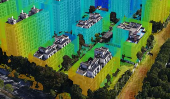
Key Technologies of the Noise Map
The core supporting technologies of the noise map include five major directions: noise source characteristic models and supporting algorithms based on noise map construction, noise map algorithms enabling high-precision prediction and inversion, 3D noise map visualization technology suitable for large-scale urban scenarios, dynamic update algorithms for 3D noise maps ensuring data timeliness, and an integrated urban acoustic environment management system serving comprehensive management.
Integrated Urban Acoustic Environment Management System
Among them, the integrated urban acoustic environment management system is a specialized system built to meet the actual needs of urban acoustic environment planning formulation, real-time monitoring, effect evaluation, pollution prevention and control, and daily management. This system integrates GIS geographic information technology, noise map technology, as well as software and hardware resources such as data transmission equipment, control terminals, display devices, and dedicated control software. It can conduct real-time monitoring, quality trend prediction and forecasting, environmental impact assessment, and information recording and storage of the acoustic environment in different urban areas, forming a complete closed-loop acoustic environment management.
In practical application, the system deploys automatic noise monitoring equipment in acoustic environment functional areas, key control areas, along traffic noise sources, and at key monitoring points. With the help of multiple transmission links such as private networks, the Internet, and mobile communication networks, all noise data collected from monitoring points are uniformly transmitted to the backend monitoring system (i.e., the "Integrated Urban Acoustic Environment Management System"). The system classifies and processes these data, specifically including monitoring data of acoustic environment functional areas, overall regional monitoring data, special monitoring data of road sound sources, and noise map-related data. Through information-based classification and integration, structured data resources are formed, providing detailed and reliable data support for the preparation of urban acoustic environment evaluation reports, the formulation of pollution prevention and control plans, and planning management decisions.
Keyword: